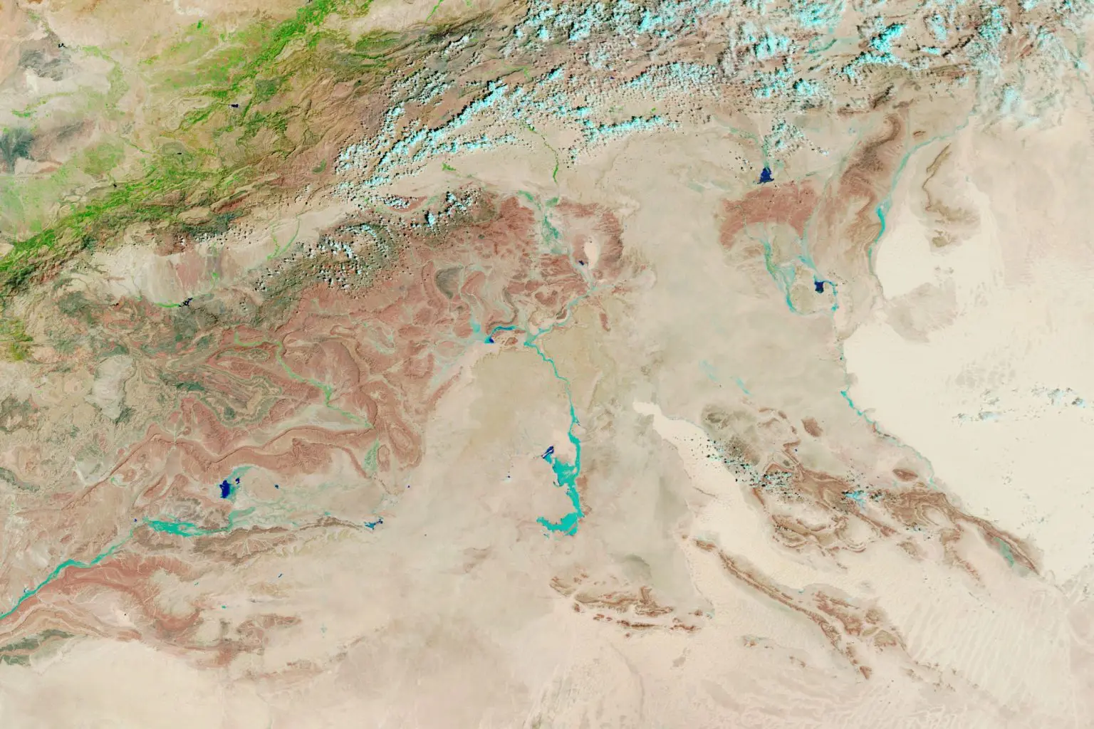
NASA’s Terra satellite has captured striking images of rare floods that swept across the normally dry regions of Morocco, Nasa’s Earth Observatory showed.
The floods resulted from an extratropical cyclone that hit the northwestern desert on September 7-8, 2024, drenching large parts of Morocco, Algeria, Tunisia, and Libya.
MODIS, NASA’s Moderate Resolution Imaging Spectroradiometer, captured the floods on September 10, 2024, showing vast water runoff across the affected areas in Morocco.
The rainfall from the cyclone was equivalent to what some regions in the desert receive in a year. Floods disrupted roads and electricity in several Moroccan villages.
Experts noted that lakes in Morocco’s Iriqui National Park filled up, an extremely rare occurrence, after this intense storm.
NASA’s IMERG data shows rainfall accumulation exceeding 200 millimeters in some regions, a significant increase for the typically dry desert.
“This is unusual, as extratropical cyclones rarely bring this level of rain to the Sahara,” said Moshe Armon of the Hebrew University of Jerusalem.


